ARTICLE

ARTICLE

Explorer Profile: Navakanesh M Batmanathan, Earthquake Geologist

Explorer Profile: Navakanesh M Batmanathan, Earthquake Geologist

What if you could do something to help people who live in areas that are prone to earthquakes? You might not be able to tell them where or when an earthquake may occur, but you could possibly help minimize the impact of the deadly energy that is released in Earth’s crust. This is just what National Geographic Young Explorer Navakanesh M Batmanathan is trying to do.

Grades

9 - 12

Subjects

Earth Science, Geology

Image

Navakanesh M Batmathan

Navakanesh M Batmathan helps identify places vulnerable to earthquakes to help engineers, designers, and planners make buildings to avoid or withstand earthquakes.

Photograph from Navakanesh M Batmathan
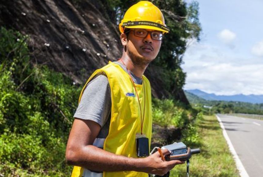
Navakanesh M Batmathan helps identify places vulnerable to earthquakes to help engineers, designers, and planners make buildings to avoid or withstand earthquakes.

Earthquakes are unpredictable. Scientists agree that predicting when and where an earthquake will occur and how big it will be is not yet possible. Therefore, much research has focused on coming up with ways to reduce the damage from earthquakes, rather than trying to predict when they will occur. Specifically, finding more information about the subsurface of an area, including where faults—earthquake-sensitive areas—may be located, helps developers and others make safer, sturdier choices when constructing a building. This is where Navakanesh M Batmanathan, a 2017 National Geographic Young Explorer, is focusing his efforts.

M Batmanathan is an earthquake geologist who is currently a research assistant at Southeast Asia Disaster Prevention Research Initiative and simultaneously pursuing his Ph.D. at the National University of Malaysia. He is focusing on mapping the areas surrounding a major earthquake fault in Borneo. The southeast Asian island is held by Malaysia and Brunei in the north, and Indonesia in the south. Faults are places in Earth’s crust that are vulnerable to sudden movement between masses of rock, resulting in occasional earthquakes. M Batmanathan is working to map the faults, as well as the infrastructure in the area of the faults, to hopefully reduce the potential damage that can be caused by an earthquake. Developers and engineers can use this knowledge to plan where it is safest to build and where earthquake-resistant structures are needed.

M Batmanathan is using a variety of tools to map faults. Working on the ground to map the area is just one of the methods he employs. He also uses images from satellites and ground-penetrating radar. Ground-penetrating radar, or GPR, is a technology that generates a cross-sectional image of the subsurface without disturbing the soil, eliminating the need to drill into the ground. It has many applications, from determining the depth of the water table to better understanding the composition of soils and rock for building projects. M Batmanathan and others are using this technology to map faults, and the areas around faults, to gain a clearer picture of potential earthquake hazards.

It might not ever be possible to know exactly when or where an earthquake will happen, but M Batmanathan hopes that his work will help educate people and better prepare them for the inevitable.

Media Credits

The audio, illustrations, photos, and videos are credited beneath the media asset, except for promotional images, which generally link to another page that contains the media credit. The Rights Holder for media is the person or group credited.

Director
Tyson Brown, National Geographic Society
Author
National Geographic Society
Production Managers
Gina Borgia, National Geographic Society
Jeanna Sullivan, National Geographic Society
Program Specialists
Sarah Appleton, National Geographic Society, National Geographic Society
Margot Willis, National Geographic Society
Producer
Clint Parks
Intern
Roza Kavak
other
Last Updated

April 22, 2024

For information on user permissions, please read our Terms of Service. If you have questions about how to cite anything on our website in your project or classroom presentation, please contact your teacher. They will best know the preferred format. When you reach out to them, you will need the page title, URL, and the date you accessed the resource.

Media

If a media asset is downloadable, a download button appears in the corner of the media viewer. If no button appears, you cannot download or save the media.

Text

Text on this page is printable and can be used according to our Terms of Service.

Interactives

Any interactives on this page can only be played while you are visiting our website. You cannot download interactives.

Related Resources