MAP

MAP

MapMaker: Perpetual Planet Mount Everest Expedition

MapMaker: Perpetual Planet Mount Everest Expedition

A multidisciplinary team of scientists collects data from the highest point in the world to learn more about climate change. Learn more about their work through this interactive map.

Grades

5 - 12

Subjects

Geographic Information Systems (GIS), Human Geography, Physical Geography, Geography

Image

MapMaker: Perpetual Planet Mount Everest Expedition

This map details where scientists with the National Geographic and Rolex Perpetual Planet Everest Expedition have collected samples from ice cores, weather stations, stream surface water and surface snow in their multidisciplinary study of climate change.

National Geographic Society / Esri
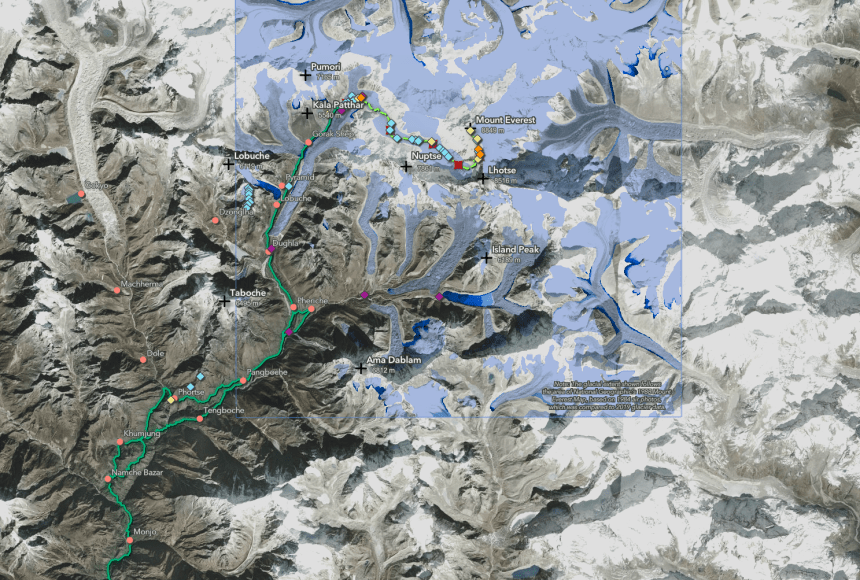
This map details where scientists with the National Geographic and Rolex Perpetual Planet Everest Expedition have collected samples from ice cores, weather stations, stream surface water and surface snow in their multidisciplinary study of climate change.

Summary: This map details where scientists with the National Geographic and Rolex Perpetual Planet Everest Expedition have collected samples from ice cores, weather stations, stream surface water and surface snow in their multidisciplinary study of climate change.

Location: Mount Everest, Himalaya mountain range, Nepal and Tibet

Explorer’s Goals: The highest point in the world is hugely important to scientists studying climate change because there is a significant amount of ice in the glaciers and the people living downstream depend on the steady melting ice for their water. Scientists with the National Geographic and Rolex Perpetual Planet Everest Expedition are researching climate change, weather, water resources, and changes to plant, insect, and wildlife populations.

Data Collected: A multidisciplinary team of scientists from the fields of glaciology, mapping, geology, biology, and meteorology collects data in their respective areas of expertise to learn more about climate change. For instance, glaciologists study ice cores akin to tree rings to learn more about past climate information, biologists collect water from beneath the ice in high altitude lakes to examine species living at the highest place in the world, and meteorologists collect temperature change data from weather stations to gain a fuller picture of long-term trends in climate.

Questions:

  • Open the interactive version of the map in National Geographic MapMaker. Click on “Measure” and practice using both tools provided. What is the distance between Camp 2 and Camp 3? What is the elevation change between Camp 2 and Camp 3?
  • Zoom in on Island Peak. How has the size of the glacier changed between 1962 and 2018? Why do you think this could be important?
Media Credits

The audio, illustrations, photos, and videos are credited beneath the media asset, except for promotional images, which generally link to another page that contains the media credit. The Rights Holder for media is the person or group credited.

Writers
Dan Byerly, National Geographic Society
Kate Gallery, National Geographic Society
Cartographer
Erica Goldfinger, National Geographic Society
Partner Organization
Last Updated

September 9, 2024

For information on user permissions, please read our Terms of Service. If you have questions about how to cite anything on our website in your project or classroom presentation, please contact your teacher. They will best know the preferred format. When you reach out to them, you will need the page title, URL, and the date you accessed the resource.

Media

If a media asset is downloadable, a download button appears in the corner of the media viewer. If no button appears, you cannot download or save the media.

Text

Text on this page is printable and can be used according to our Terms of Service.

Interactives

Any interactives on this page can only be played while you are visiting our website. You cannot download interactives.

Related Resources