Scientists use various technologies to understand the atmosphere’s changing composition, chemistry, and weather.
Grades
2 - 12
Subjects
Earth Science, Meteorology, Engineering
Image
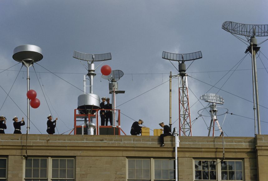
Cadets Deploy Weather Balloons
Weather balloons—like those deployed by these cadets from the United States Merchant Marine Academy—collect data on weather conditions. An attached instrument, a radiosonde, measures temperature, pressure, and relative humidity.
Photograph by Volkmar K. Wentzel
Leveled by
Share on Twitter
Share on Facebook
Share on Pinterest
Share on Google Classroom
Share on MS Teams
Share via email
Print
Selected text level
The is a blanket of gases that surrounds the planet, reaching up to about 97 kilometers (60 miles) at its upper limits. While that may not sound like it is too far, imagine trying to observe an event from that distance. Watching a baseball game from that far away would be impossible. It's also difficult to study the atmosphere from so far away. Scientists require instruments to see what happens in the atmosphere.
Thermometers and Barometers
One of the first tools ever used to observe properties of the atmosphere was the thermometer. It was invented in Italy in the 1590s by Galileo Galilei. He designed a device with a hollow glass bulb at one end and a hollow, open tube at the other. Galileo held the bulb end in his hands, allowing it to heat up, then turned the device upside-down in a water-filled basin. The water then rose into the hollow tube. How high the water moved up or down depended on the temperature of the surrounding air. As the air in the bulb cooled, there was less pressure because it took up less space. The water moved higher up the tube toward the bulb because of the lower pressure. Because of this, higher water levels meant cold temperatures and lower water levels meant hot temperatures. In 1612, another Italian scientist improved upon Galileo's thermometer design by adding a number scale so that temperatures could be read.
About 50 years later, one of Galileo's apprentices, Evangelista Torricelli, invented the barometer, an instrument that measures air pressure. Air pressure is caused by the weight of the atmosphere pressing down in a certain location. When the air pressure is high, the atmosphere is stable. When the air pressure is low, the atmosphere is stormy.
and
Thermometers, barometers, and other instruments are used to explore the atmosphere nearby. But what if scientists want to collect measurements where there are no instruments? For this, scientists depend on instruments—tools that obtain information from far away.
High in the atmosphere, the temperatures are below zero and the air is thin. Scientists had to design instruments that can collect observations in these conditions. One of this type of instrument is the weather balloon. It carries a radiosonde, which measures temperature, pressure, and relative humidity, or how much water vapor is in the air. It also has a radio transmitter that relays this data back to scientists every few seconds. Scientists calculate wind speed and wind directions by tracking the balloon's position. Then they use this data to create weather forecasts and provide input for weather models.
A weather balloon can only travel about 32 kilometers (20 miles) up from Earth's surface. High in the atmosphere, the low air pressure outside of the balloon causes the air inside the balloon to swell. If it gets too high, it expands and pops. To collect data at higher altitudes, scientists turn to .
Weather Satellites
In the 1960s, NASA launched the nation's first weather satellite called TIROS I. Today, weather satellites continuously circle our planet hundreds of kilometers above its surface. They are one of the most effective tools for studying Earth. Satellites collect data and images of atmospheric events around the globe. They relay the information from space back to Earth's surface.
Satellites monitor many things. They can track things, such as clouds, lightning, snow, ice, and hurricanes. But they can also measure other events, such as wildfires, volcanoes, ocean temperatures, and solar flares. Satellites also help scientists monitor the atmosphere's chemistry. They measure , air pollution, and .
is another form of technology that captures images of the atmosphere. Unlike weather balloons and satellites, which scan the atmosphere from above, radar works by scanning it from the ground. Radar sends out pulses of energy called radio waves. It then sees how the waves interact with objects in the air. This reveals the location of rain, snow, and other types of precipitation.
Doppler Radar, Computer Models
One kind of radar, called Doppler radar, can detect a storm's location, and its movement too. It can tell whether a storm is approaching or moving out of a specific area. It can also see if a weather system is turning, or rotating, a sign of possible .
You have likely heard meteorologists mention a form of technology used to create your weather forecast. These are weather models designed by computer programs. They use mathematical equations that represent how the atmosphere behaves in real life. Data, such as temperature and pressure, is fed into the program. The programs then predict what will happen in the atmosphere in the future. The computers solve the equations and make models much faster than any human could. The model estimates what the atmosphere is likely to do before it actually does it.
Today's technologies allow us to explore the atmosphere in extremely fine detail.
Credits
Media Credits
The audio, illustrations, photos, and videos are credited beneath the media asset, except for promotional images, which generally link to another page that contains the media credit. The Rights Holder for media is the person or group credited.
Director
Tyson Brown, National Geographic Society
Author
National Geographic Society
Production Managers
Gina Borgia, National Geographic Society
Jeanna Sullivan, National Geographic Society
Program Specialists
Sarah Appleton, National Geographic Society, National Geographic Society
Margot Willis, National Geographic Society
Producer
Clint Parks
other
Last Updated
October 19, 2023
User Permissions
For information on user permissions, please read our Terms of Service. If you have questions about how to cite anything on our website in your project or classroom presentation, please contact your teacher. They will best know the preferred format. When you reach out to them, you will need the page title, URL, and the date you accessed the resource.
Media
If a media asset is downloadable, a download button appears in the corner of the media viewer. If no button appears, you cannot download or save the media.
Text
Text on this page is printable and can be used according to our Terms of Service.
Interactives
Any interactives on this page can only be played while you are visiting our website. You cannot download interactives.