ENCYCLOPEDIC ENTRY
ENCYCLOPEDIC ENTRY
Tigris River
Tigris River
The Tigris River, which borders Mesopotamia in the Fertile Crescent, has been a key source of irrigation, power and travel that dates back to the earliest known civilizations.
Grades
5 - 12+
Subjects
Earth Science, Geography, Human Geography, Physical Geography
Image
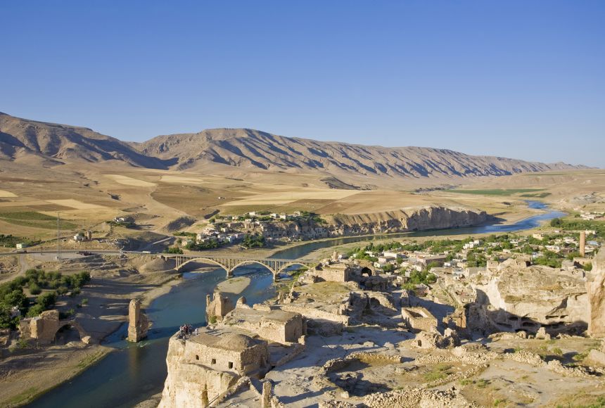
Overlooking the Tigris River
The Tigris River is one of the most important waterways in the Fertile Crescent, and has supported cities like Hasankeyf, Türkiye, for centuries.
Photograph by Jane Sweeney
Learning materials
Instructional Links
Surrounded by four countries (Iran, Iraq, Türkiye and Syria), the Tigris River is the second largest river in western Asia. With the Euphrates River, it makes up a river system that borders Mesopotamia in the area known as the Fertile Crescent. An important source of both travel and irrigation, the Tigris also has a rich history that dates back to the earliest known civilizations because of its importance to a largely arid region.
Originating in Lake Hazer in Türkiye—a region characterized by high mountains—the river flows parallel with the Euphrates River. The two eventually join, emptying into the Persian Gulf in the lowlands in an area known as the Shatt Al-Arab. More than half of the Tigris can be found in Iraq. Other rivers that flow into it include the Greater Zab, the Lesser Zab, the Al-Adhaim, the Diyala and the Karkheh.
While the local population uses the Tigris as a source of fresh water, agriculture is the primary focus for the people near the river. The region’s low rainfall and hot, dry summers mean that irrigation is necessary for growing crops. While such irrigation can sometimes lead to problems in water quality, the Tigris is generally considered to have acceptable quality.
The Tigris is also used for hydropower, which has led to the construction of dams in the region to harness the power of its flow. The work of Julia Harte, under funding from a National Geographic grant, explored the consequences of using such power on the history and people of the area. Innovations and advancements along the same lines of hydropower will continue to create an evolving landscape for local governments and people of the region.
Credits
Media Credits
The audio, illustrations, photos, and videos are credited beneath the media asset, except for promotional images, which generally link to another page that contains the media credit. The Rights Holder for media is the person or group credited.
Director
Author
Production Managers
Program Specialists
other
Last Updated
June 27, 2025
User Permissions
For information on user permissions, please read our Terms of Service. If you have questions about how to cite anything on our website in your project or classroom presentation, please contact your teacher. They will best know the preferred format. When you reach out to them, you will need the page title, URL, and the date you accessed the resource.
Media
If a media asset is downloadable, a download button appears in the corner of the media viewer. If no button appears, you cannot download or save the media.
Text
Text on this page is printable and can be used according to our Terms of Service.
Interactives
Any interactives on this page can only be played while you are visiting our website. You cannot download interactives.