ENCYCLOPEDIC ENTRY
ENCYCLOPEDIC ENTRY
United States Geological Survey
United States Geological Survey
The United States Geological Survey (USGS) is a government–run agency that provides decision makers with reliable scientific data about Earth systems, natural disasters, and natural resources.
Grades
5 - 8
Subjects
Geography, Geographic Information Systems (GIS), Human Geography, Physical Geography
Image
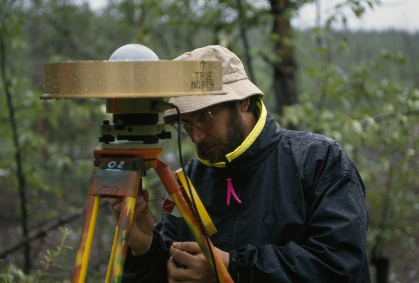
USGS Surveyor
Scientist Doug Caprette ventures out in the rain to remove a GPS sensor from its spot on a USGS benchmark in the woods of McCarthy, Alaska, where it had been gathering data for a study on regional deformation caused by tectonic movements.
Photograph by George F. Mobley
The United States Geological Survey (USGS) is an agency of the United States Department of the Interior. It is a scientific agency that researches Earth systems. Its mission is to make scientific data available to help people understand Earth, prepare for natural disasters, and manage the nation’s natural resources. The agency also provides data to lawmakers and community leaders to assist in decision-making.
The USGS was established in 1879. Originally its mission was to study the nation’s land, including natural resources and geological structures. This research was to be used to classify public lands and make decisions about land use. Since its formation, the USGS has evolved to meet the changing needs of the nation. Over time, its activities have ranged from surveying oil and natural gas resources to mapping the landscape to assisting in conservation efforts.
Today the USGS is involved in a variety of areas of scientific research. These “Mission Areas” include Core Science Systems, Ecosystems, Energy and Minerals, Land Resources, Water Resources, Environmental Health, and Natural Hazards. Another Mission Area, Core Science Systems, is tasked with “characterizing and understanding complex Earth and biological systems through research, modeling, mapping, and the production of high-quality data.”
Through its Natural Hazards Mission Area, the USGS plays an important role in protecting people and property. It monitors natural hazards such as earthquakes, volcanoes, and hurricanes. The data collected by the agency help communities predict and prepare for natural disasters.
Credits
Media Credits
The audio, illustrations, photos, and videos are credited beneath the media asset, except for promotional images, which generally link to another page that contains the media credit. The Rights Holder for media is the person or group credited.
Director
Author
Production Managers
Program Specialists
other
Last Updated
October 19, 2023
User Permissions
For information on user permissions, please read our Terms of Service. If you have questions about how to cite anything on our website in your project or classroom presentation, please contact your teacher. They will best know the preferred format. When you reach out to them, you will need the page title, URL, and the date you accessed the resource.
Media
If a media asset is downloadable, a download button appears in the corner of the media viewer. If no button appears, you cannot download or save the media.
Text
Text on this page is printable and can be used according to our Terms of Service.
Interactives
Any interactives on this page can only be played while you are visiting our website. You cannot download interactives.