IDEA SET
IDEA SET
MapMaker: World Water Map
MapMaker: World Water Map
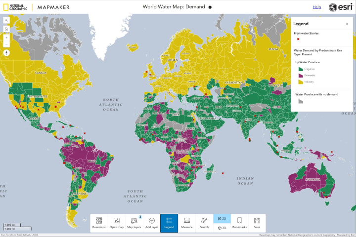
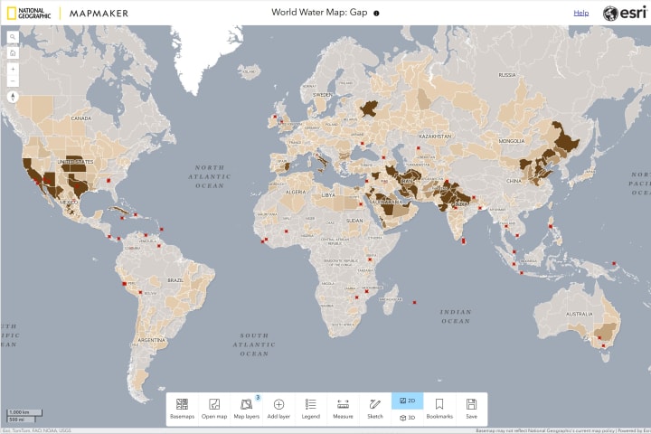
Stories about the world’s water are illuminated in these interactive MapMaker maps, developed from the work of National Geographic Explorer Marc Bierkens and his team at Utrecht University. One map details demand for water; another identifies gaps by examining how much usage is sustainable for the region’s rivers and groundwaters. Both maps also pinpoint stories about freshwater issues that learners have encountered in their own communities.
Grades
5 - 12+
Subjects
Human Geography, Physical Geography, Geography, Geographic Information Systems (GIS), Earth Science, Conservation, Climatology, Storytelling
Instructional Links
Background
Everyone uses fresh water, but not everyone has all they need. What happens when people need more water than the water cycle provides? What are the consequences of humans disrupting the water cycle?
In 2022, National Geographic Society launched the World Freshwater Initiative, a five-year program to illuminate freshwater availability issues around the world. As part of that initiative, National Geographic published the World Water Map in 2023, highlighting the work of National Geographic Explorer and hydrology professor Marc Bierkens, alongside Niko Wanders, Bram Droppers, Myrthe Leijnse, and the rest of Bierkens’ team at Utrecht University in the Netherlands. They developed the global model that is the basis for the information and simulates how water travels on the Earth’s surface and eventually finds its way to the sea. The information collected by the team includes more than 40 years of historical data, and by combining this with the model, they can see where people use a lot of water and how this affects the water cycle.
To further share the team’s work with teachers and learners around the world, Bierkens and his team created MapMaker versions of these maps in the fall of 2024 in collaboration with National Geographic Society and Esri. The interactive MapMaker maps enable teachers and learners to examine demand in one MapMaker map and explore the concept and realities of water gaps in a second MapMaker map.
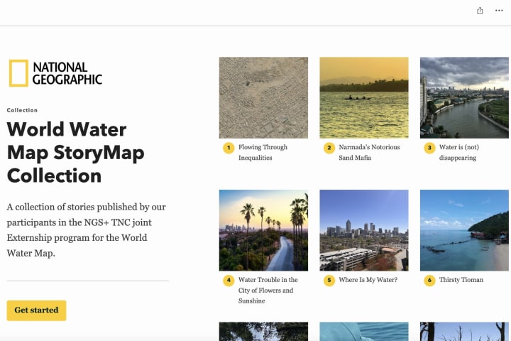
Overlaid on both maps are stories created by participants in the National Geographic Society and Nature Conservancy’s Freshwater Externship. Their stories provide learners with localized observations about the freshwater issues that externs have encountered in their own communities. Visualized together, the data and narratives showcased on the MapMaker maps tell layered stories about the world’s water.
As learners explore the maps, keep in mind the following questions:
- Where do people use the most water? How are they using it?
- Where do people use more water than rivers, groundwater and shallow aquifers provide?
- What steps can we take as individuals, communities and a global society to ensure that we have enough water for the future?

Map #1: World Water Demand
This map allows learners to explore the world’s water use and includes layers that learners can toggle on and off to examine total water demand and total water demand by use type.
Use this Learning Tool with your students and get detailed information about each of the map's layers.
Learning Tool: World Water Demand

Map #2: World Water Gap
The World Water Gap map includes a layer that identifies the average annual demand for water beyond the renewable supply in various regions of the world, highlighting where humans are using more water than the water cycle can provide. Learners can toggle on and off an additional layer to explore how the water that accounts for that water gap is currently being used.
Use this Learning Tool with your students and get detailed information about each of the map's layers.
Learning Tool: World Water Gap
Media Credits
The audio, illustrations, photos, and videos are credited beneath the media asset, except for promotional images, which generally link to another page that contains the media credit. The Rights Holder for media is the person or group credited.
In Partnership With
Writers
Reviewers
Explorer Reviewers
Last Updated
November 7, 2024
For information on user permissions, please read our Terms of Service. If you have questions about how to cite anything on our website in your project or classroom presentation, please contact your teacher. They will best know the preferred format. When you reach out to them, you will need the page title, URL, and the date you accessed the resource.
Media
If a media asset is downloadable, a download button appears in the corner of the media viewer. If no button appears, you cannot download or save the media.
Text
Text on this page is printable and can be used according to our Terms of Service.
Interactives
Any interactives on this page can only be played while you are visiting our website. You cannot download interactives.

