IDEA SET
IDEA SET
Exploring Oceans
Exploring Oceans
Idea Set focusing on the Pristine Seas project.
Grades
4 - 10
Subjects
Biology, Earth Science, Oceanography, Geography, Geographic Information Systems (GIS)
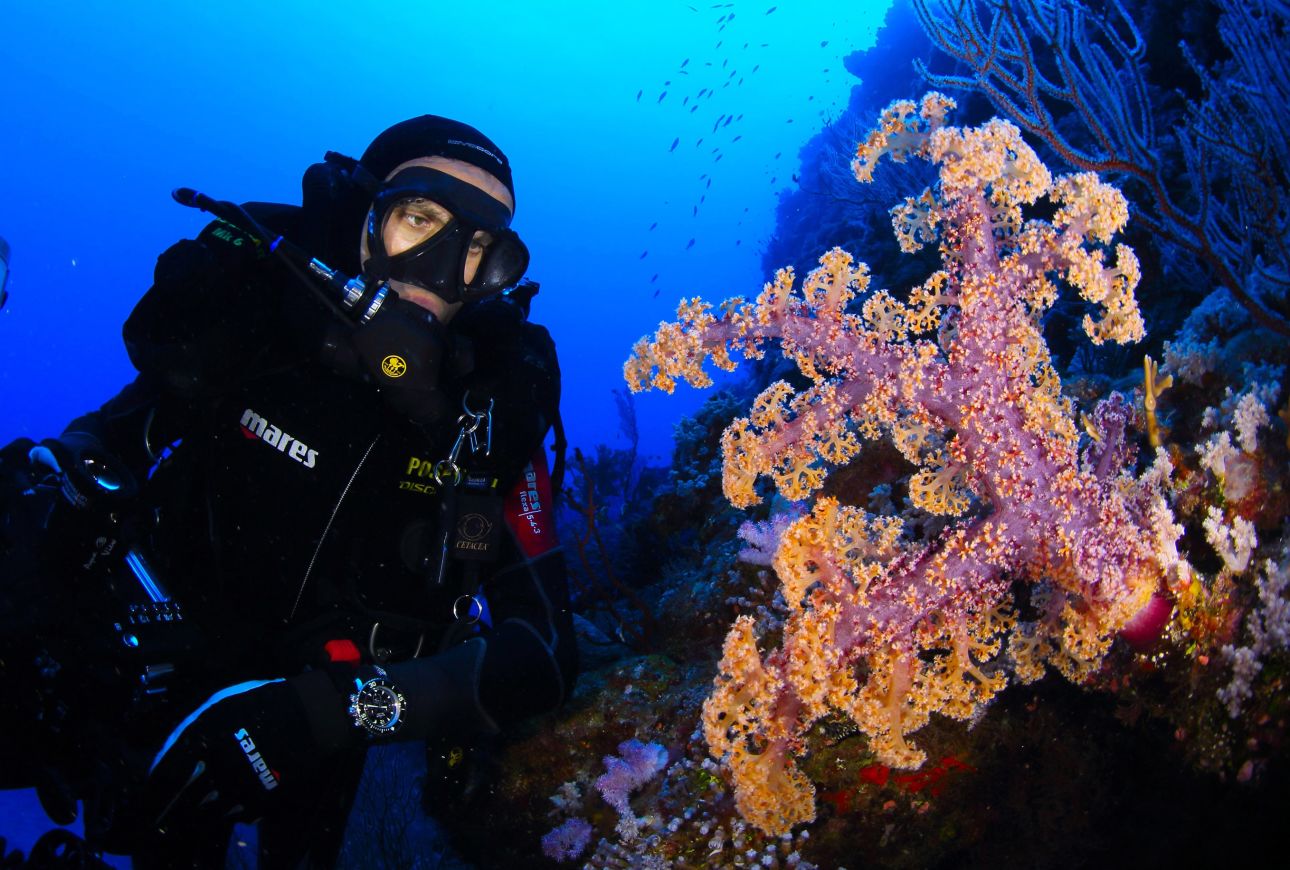
Manu San Felix/National Geographic Creative
This resource is also available in Spanish.
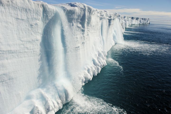
National Geographic’s Pristine Seas project sends expedition teams to remote, unexplored places in the ocean. Utilizing some of the latest technologies—from drones and drop cameras to rebreather diving technology, submarines, and autonomous underwater vehicles—the team and key partners work together to conduct comprehensive surveys of these marine environments. The expedition findings are then used to advocate for better protection of these ocean areas. Here are some ideas to get your students learning about our ocean environment through Google Earth.
These ideas closely connect to the National Geography Standards, some of the Next Generation Science Standards, and many of the Geography Standards in the C3 Framework.
Pristine Seas
Have students view the Pristine Seas Google Earth Voyager Story and use the Pristine Seas: Exploring Islands & Coasts worksheet to organize their learning. Then have them share aloud from their worksheets, taking time to solicit student shares from each of the columns. Then ask students: What do you know about the issues affecting our ocean? After soliciting students' ideas, have students read the encyclopedia entry on the ocean. Give students time to read through, or briefly discuss, each problem. Brainstorm a list of service learning projects the class could take on to address one or more of these issues, and consider moving forward with one.
Mapping the Ocean Floor
Have your students use Google Earth to study the underwater features of our planet. Ask them if they recognize any patterns. What they are seeing is not simply the result of a photograph from space; it’s a bathymetric map constructed from radar data collected on satellites and echo sounder data collected from ships. Students can get more background information from our encyclopedia entry on bathymetry.
Google Earth imagery shows us the features of underwater seascapes, but it lacks a lot of detail—the reality is that only approximately 5 percent of our ocean has been precisely mapped. Have students find the Mariana Trench, the deepest point in the ocean. The distance between the surface of the ocean and the trench’s deepest point is approximately 11 kilometers (km), or 7 miles! Ask students the following questions: What can they notice about this area, and the surrounding bathymetry? What are the closest land areas to it? Students can read more on ocean trenches or deepen their learning with the lesson, Protecting the Mariana Trench.
The Ocean and Me
Have students identify the shortest path between them and the ocean using the measure tool in the Google My Maps program. They should measure distance “as the crow flies” and record this, turning it into their “ocean address.” For example, the closest ocean access to students in Washington, D.C., is Cape Henlopen State Park in Delaware. Their ocean address is “169km (105 miles) from the ocean at Cape Henlopen State Park.” Next, using Google Earth, have students study the underwater bathymetry of the ocean near that point—what features do they notice? Does it appear to be shallow far off the coast? Or does it drop off rapidly? What else can they observe?
Our Warming Oceans
Data show that sea surface temperatures have risen over the last few decades and scientists suggest that heat sequestration from the atmosphere may have contributed to the increase. Have students open MapMaker: Sea Surface Temperature and study the ocean surface temperature trends. Ask students: What spatial pattern(s) are you able to observe at the global scale?
Assign groups of students to do a regional analysis in these four areas studied by the Pristine Seas expedition team: Franz Josef Land, Revillagigedo Archipelago, Galápagos Islands, the coast off of Gabon. Have students predict how these environmental phenomena regarding sea surface temperatures might impact the ocean, as well as land areas. Then have them read the Pristine Seas website and conduct additional research to answer: Was your prediction accurate? What else did you learn after reading this section and from your research?
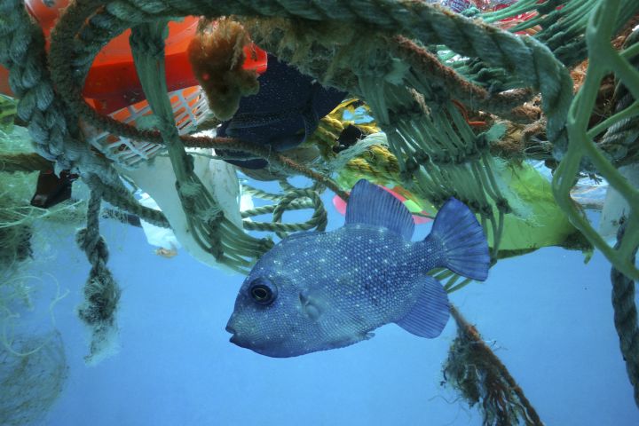
Marine Pollution
Ocean pollution comes in many forms. Have your students learn about these forms using the encyclopedia entry on the Ocean. Ask them to predict what happens to trash when it ends up in the ocean. Have students read the encyclopedia entry About the Great Pacific Garbage Patch to learn more about marine debris and then ask them to revisit and update their predictions.
Media Credits
The audio, illustrations, photos, and videos are credited beneath the media asset, except for promotional images, which generally link to another page that contains the media credit. The Rights Holder for media is the person or group credited.
Writer
Editor
Producers
special thanks
James Allen, Jessica Bean, Peter Cameron, Joel Charlebois, Charles Dabritz, Merinda Davis, Shiona Drummer, Andrette Duncan, Lise Galuga, Nicholas Gattis, Amanda Hensley, Melissa Hero, Rosalinda Jaimes, Brynn Johnson, Katherine Kauffman, Peg Keiner, Natalia LeMoyne, Joseph (Joe) Levine, Paul McAllister, Emily McAllister, Kelly McCarthy, Alvera McMillan, Michael Middleton, Pradip Misra, Raven Moore, Breanna Myles, Michele Osinski, Judith Painter, Ellie Reitz, Jeff Richardson, Rebekah Rottenberg, Terri Sallee, William (Bill) Scales, Afzal Shaikh, Miroslava Silva-Ordaz , Samantha Sinding, Dana Tatlock, Martha Thornburgh, Jessica Walsh, Brooke Whitlow, Josh Williams, Layne Zimmers.
Last Updated
June 17, 2026
For information on user permissions, please read our Terms of Service. If you have questions about how to cite anything on our website in your project or classroom presentation, please contact your teacher. They will best know the preferred format. When you reach out to them, you will need the page title, URL, and the date you accessed the resource.
Media
If a media asset is downloadable, a download button appears in the corner of the media viewer. If no button appears, you cannot download or save the media.
Text
Text on this page is printable and can be used according to our Terms of Service.
Interactives
Any interactives on this page can only be played while you are visiting our website. You cannot download interactives.