MAP
MAP
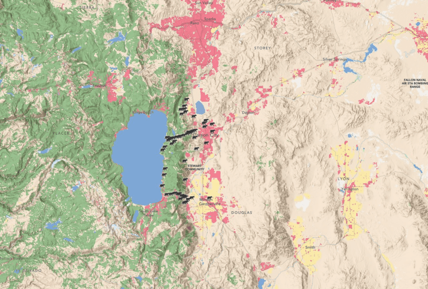
MapMaker: Black Bears Around Lake Tahoe
MapMaker: Black Bears Around Lake Tahoe
National Geographic Explorer Rae Wynn-Grant collects data to learn where black bears might come into conflict with people.
Grades
5 - 12
Subjects
Geographic Information Systems (GIS), Human Geography, Physical Geography, Geography, Conservation
Image
Black Bears Around Lake Tahoe
To study black bears safely, National Geographic Explorer Rae Wynn-Grant uses the Global Positioning System (GPS) to collect evidence of bears in an area (scratches on trees, scats, or footprints) and radio collars to understand where bears travel.
National Geographic Society / Esri

Media Credits
The audio, illustrations, photos, and videos are credited beneath the media asset, except for promotional images, which generally link to another page that contains the media credit. The Rights Holder for media is the person or group credited.
Writers
Cartographer
Partner Organization
Last Updated
April 16, 2024
For information on user permissions, please read our Terms of Service. If you have questions about how to cite anything on our website in your project or classroom presentation, please contact your teacher. They will best know the preferred format. When you reach out to them, you will need the page title, URL, and the date you accessed the resource.
Media
If a media asset is downloadable, a download button appears in the corner of the media viewer. If no button appears, you cannot download or save the media.
Text
Text on this page is printable and can be used according to our Terms of Service.
Interactives
Any interactives on this page can only be played while you are visiting our website. You cannot download interactives.